Geolocate

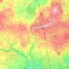
Happy Valley topographic map

Click on the map to display elevation.

About this map

Name: Happy Valley topographic map, elevation, terrain.

Location: Happy Valley, King, York Region, Golden Horseshoe, Ontario, L7B 0H4, Canada (43.95976 -79.61279 43.99976 -79.57279)

Average elevation: 302 m

Minimum elevation: 230 m

Maximum elevation: 370 m

Other topographic maps

Click on a map to view its topography, its elevation and its terrain.
Holland Marsh

Canada > Ontario > York Region > King

Average elevation: 240 m

King—Vaughan

Canada > Ontario > York Region > King

Average elevation: 265 m

Bell's Lake

Canada > Ontario > York Region > King

Average elevation: 295 m

Kettle Lake Park

Canada > Ontario > York Region > King > King City

Average elevation: 294 m

Gear up for your next adventure:

🧺Waterproof Dry Sacks - Organize your pack and keep electronics safe from rain and river crossings
🧺Fast-Dry Microfiber Towels - Large towels that pack down to the size of an orange
🎒Tactical Waist Packs - Quick access to your compass, phone, and snacks while walking
🪢550 Survival Paracord - Versatile cordage for gear repair and emergency lashing
📚Map Reading & Navigation Guides - Master the art of interpreting topographic contours and symbols

As an Amazon Associate, this site earns from qualifying purchases at no extra cost to you.