
Montalegre topographic map
Interactive map
Click on the map to display elevation.
About this map
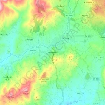
Name: Montalegre topographic map, elevation, terrain.
Location: Montalegre, Vila Real, Alto Tâmega, Norte, 5470-234, Portugal (41.78322 -7.83231 41.86322 -7.75231)
Average elevation: 1,016 m
Minimum elevation: 877 m
Maximum elevation: 1,309 m