
Thank you for supporting this site ❤️
Make a donation
Make a donation
Gear up for your next adventure:
As an Amazon Associate, this site earns from qualifying purchases at no extra cost to you.
Castrovalva topographic map
Click on the map to display elevation.
Thank you for supporting this site ❤️
Make a donation
Make a donation
Gear up for your next adventure:
As an Amazon Associate, this site earns from qualifying purchases at no extra cost to you.
About this map
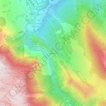
Name: Castrovalva topographic map, elevation, terrain.
Location: Castrovalva, Anversa degli Abruzzi, L'Aquila, Abruzzo, Italy (41.96327 13.79317 42.00327 13.83317)
Average elevation: 994 m
Minimum elevation: 468 m
Maximum elevation: 1,659 m
Thank you for supporting this site ❤️
Make a donation
Make a donation
Gear up for your next adventure:
As an Amazon Associate, this site earns from qualifying purchases at no extra cost to you.