
Omoa topographic map
Interactive map
Click on the map to display elevation.
About this map
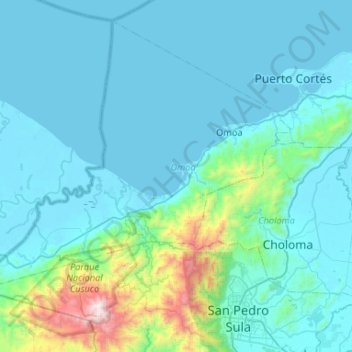
Name: Omoa topographic map, elevation, terrain.
Location: Omoa, Cortés, Honduras (15.51367 -88.47304 15.90756 -87.94634)
Average elevation: 203 m
Minimum elevation: -1 m
Maximum elevation: 2,209 m
Other topographic maps
Click on a map to view its topography, its elevation and its terrain.