
Thank you for supporting this site ❤️
Make a donation
Make a donation
Gear up for your next adventure:
As an Amazon Associate, this site earns from qualifying purchases at no extra cost to you.
Ballık topographic map
Click on the map to display elevation.
Thank you for supporting this site ❤️
Make a donation
Make a donation
Gear up for your next adventure:
As an Amazon Associate, this site earns from qualifying purchases at no extra cost to you.
About this map
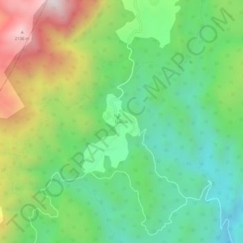
Name: Ballık topographic map, elevation, terrain.
Location: Ballık, Altınyayla, Burdur, Mediterranean Region, Turkey (36.86041 29.40813 36.90041 29.44813)
Average elevation: 1,528 m
Minimum elevation: 1,147 m
Maximum elevation: 2,216 m
Thank you for supporting this site ❤️
Make a donation
Make a donation
Gear up for your next adventure:
As an Amazon Associate, this site earns from qualifying purchases at no extra cost to you.