
Estes Park topographic map
Interactive map
Click on the map to display elevation.
About this map
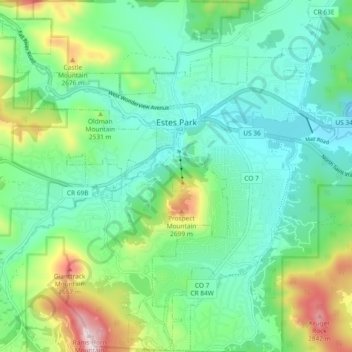
Name: Estes Park topographic map, elevation, terrain.
Average elevation: 2,429 m
Minimum elevation: 2,258 m
Maximum elevation: 2,897 m
Other topographic maps
Click on a map to view its topography, its elevation and its terrain.
Estes Park
Verenigde Staten > Colorado > Larimer County
Estes Park, Larimer County, Colorado, 80517, Verenigde Staten
Average elevation: 2,430 m
Poudre Lake
Verenigde Staten > Colorado > Larimer County
Poudre Lake, Larimer County, Colorado, Verenigde Staten
Average elevation: 3,408 m