Geolocate

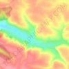
Ustechko topographic map

Click on the map to display elevation.

About this map

Name: Ustechko topographic map, elevation, terrain.

Location: Ustechko, Tovste Settlement Hromada, Chortkiv Raion, Ternopil Oblast, 48634, Ukraine (48.75055 25.58605 48.78614 25.64121)

Average elevation: 249 m

Minimum elevation: 151 m

Maximum elevation: 325 m

Other topographic maps

Click on a map to view its topography, its elevation and its terrain.
Hodiv

Ukraine > Ternopil Oblast

Average elevation: 371 m

Gear up for your next adventure:

⌚Altimeter Barometer Watches - Outdoor watches with built-in sensors to track altitude changes and weather shifts
📻Handheld UHF Radios - Critical communication for groups in the Australian outback
🔋Rechargeable Batteries - Eco-friendly power for high-drain GPS units and flashlights
🚴Cycling Backpacks - Backpacks for cyclists
👣Snake & Scrub Gaiters - Protection against spinifex, mud, and snakes while walking off-track

As an Amazon Associate, this site earns from qualifying purchases at no extra cost to you.