
Thank you for supporting this site ❤️
Make a donation
Make a donation
Gear up for your next adventure:
As an Amazon Associate, this site earns from qualifying purchases at no extra cost to you.
Bischofsheim topographic map
Click on the map to display elevation.
Thank you for supporting this site ❤️
Make a donation
Make a donation
Gear up for your next adventure:
As an Amazon Associate, this site earns from qualifying purchases at no extra cost to you.
About this map
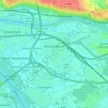
Name: Bischofsheim topographic map, elevation, terrain.
Location: Bischofsheim, Kreis Groß-Gerau, Hesse, Germany (49.97105 8.33314 50.00176 8.41030)
Average elevation: 91 m
Minimum elevation: 81 m
Maximum elevation: 132 m
Thank you for supporting this site ❤️
Make a donation
Make a donation
Gear up for your next adventure:
As an Amazon Associate, this site earns from qualifying purchases at no extra cost to you.