Geolocate

Crownthorpe topographic map

Click on the map to display elevation.

About this map

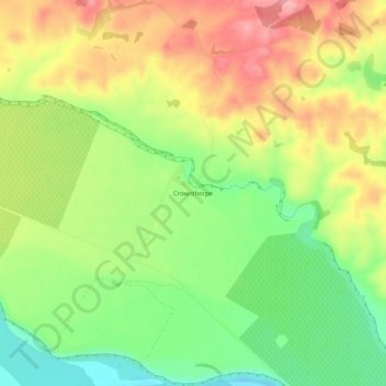
Name: Crownthorpe topographic map, elevation, terrain.

Location: Crownthorpe, Hastings District, Hawke's Bay, New Zealand (-39.59106 176.54182 -39.55106 176.58182)

Average elevation: 168 m

Minimum elevation: 102 m

Maximum elevation: 239 m

Gear up for your next adventure:

👄SPF Lip Balm - Prevent sun and wind-burnt lips on mountain ridges
🎨Portable Watercolor Kits - Paint the landscapes and topographic views you discover
🏃Compression Recovery Socks - Reduce leg fatigue after heavy days of elevation gain
🪢Paracord - Multi-purpose survival cord
🦯Trekking Poles - Walking poles for hiking stability

As an Amazon Associate, this site earns from qualifying purchases at no extra cost to you.