
Ware County topographic map
Interactive map
Click on the map to display elevation.
About this map
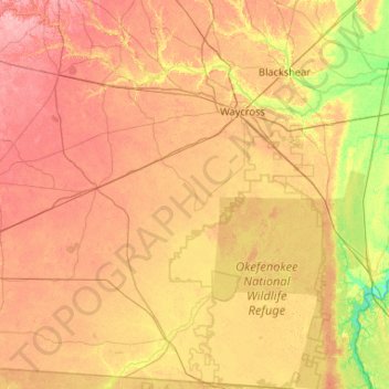
Name: Ware County topographic map, elevation, terrain.
Location: Ware County, Georgia, USA (30.56848 -82.70133 31.46905 -82.13175)
Average elevation: 42 m
Minimum elevation: 0 m
Maximum elevation: 84 m
Other topographic maps
Click on a map to view its topography, its elevation and its terrain.
Georgetown
USA > Georgia > Georgetown
Georgetown, Chatham County, Georgia, 31416, USA
Average elevation: 4 m
Cameron Point
USA > Georgia > Cameron Point
Cameron Point, Hall County, Georgia, 30506:30534, USA
Average elevation: 339 m
Double Lakes
Double Lakes, Sylvester Road, Turner County, Georgia, USA
Average elevation: 91 m
Arabia Mountain
USA > Georgia > Stonecrest
Arabia Mountain, Stonecrest, DeKalb County, Georgia, 30058-8829, USA
Average elevation: 255 m
Ferrell Crossroads
USA > Georgia > Ferrell Crossroads
Ferrell Crossroads, Early County, Georgia, USA
Average elevation: 94 m