
Chevannes topographic map
Interactive map
Click on the map to display elevation.
About this map
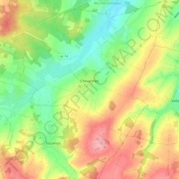
Name: Chevannes topographic map, elevation, terrain.
Average elevation: 183 m
Minimum elevation: 123 m
Maximum elevation: 255 m
Other topographic maps
Click on a map to view its topography, its elevation and its terrain.
Orgy
France > Bourgogne-Franche-Comté > Chevannes > Orgy
Orgy, Chevannes, Auxerre, Yonne, Bourgogne-Franche-Comté, France métropolitaine, 89240, France
Average elevation: 169 m