
Leysin topographic map
Interactive map
Click on the map to display elevation.
About this map
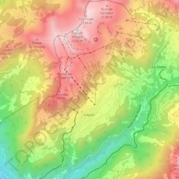
Name: Leysin topographic map, elevation, terrain.
Location: Leysin, District d'Aigle, Valdia, 1854, Suiza (46.32070 6.97711 46.38518 7.04051)
Average elevation: 1,352 m
Minimum elevation: 415 m
Maximum elevation: 2,299 m