
Manjuguni topographic map
Interactive map
Click on the map to display elevation.
About this map
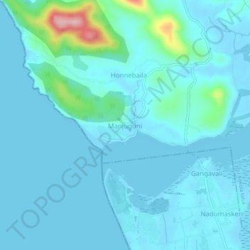
Name: Manjuguni topographic map, elevation, terrain.
Average elevation: 20 m
Minimum elevation: -5 m
Maximum elevation: 183 m
Other topographic maps
Click on a map to view its topography, its elevation and its terrain.
Achave
India > Karnataka > Ankola taluk > ಚನಗಾರ
Achave, ಚನಗಾರ, Ankola taluk, Uttara Kannada, Karnataka, India
Average elevation: 109 m