
Saint-Jean-d'Ardières topographic map
Interactive map
Click on the map to display elevation.
About this map
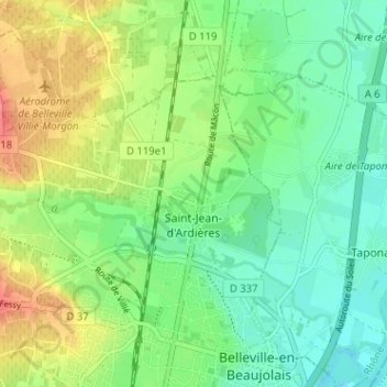
Name: Saint-Jean-d'Ardières topographic map, elevation, terrain.
Average elevation: 190 m
Minimum elevation: 166 m
Maximum elevation: 232 m
Other topographic maps
Click on a map to view its topography, its elevation and its terrain.
Château de Pizay
France > Auvergne-Rhône-Alpes > Rhône > Belleville-en-Beaujolais > Saint-Jean-d'Ardières > Pizay
Château de Pizay, Route du Château, Pizay, Saint-Jean-d'Ardières, Belleville-en-Beaujolais, Villefranche-sur-Saône, Rhône, Auvergne-Rhône-Alpes, France métropolitaine, 69220, France
Average elevation: 223 m