
Shalamar Reserve topographic map
Interactive map
Click on the map to display elevation.
About this map
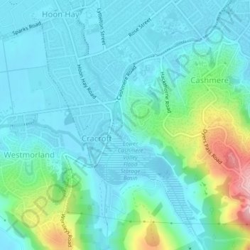
Name: Shalamar Reserve topographic map, elevation, terrain.
Average elevation: 48 m
Minimum elevation: 7 m
Maximum elevation: 218 m
Other topographic maps
Click on a map to view its topography, its elevation and its terrain.
Saint Albans
New Zealand > Canterbury > Christchurch City > Christchurch
Saint Albans, Fendalton-Waimari-Harewood Community, Christchurch, Christchurch City, Canterbury, New Zealand
Average elevation: 10 m