Geolocate

Cedar City topographic map

Click on the map to display elevation.

Cedar City

Cedar City is located in the southeast Great Basin and is approximately 20 miles (32 km) north of the northeastern edge of the Mojave Desert. Its elevation of 5,846 feet (1,782 m) gives it a somewhat cooler climate compared to the nearby St. George region, though it retains cultural ties to the city —for example, they share a daily newspaper.

Wikipedia (CC-BY-SA 3.0)

About this map

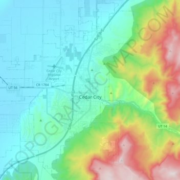
Name: Cedar City topographic map, elevation, terrain.

Location: Cedar City, Iron County, Utah, United States (37.61847 -113.19797 37.74748 -113.01272)

Average elevation: 1,975 m

Minimum elevation: 1,676 m

Maximum elevation: 2,866 m

Other topographic maps

Click on a map to view its topography, its elevation and its terrain.

Cedar Mountain

United States > Utah > Iron County

Average elevation: 2,512 m

North View

United States > Utah > Iron County

Average elevation: 3,072 m

Mammoth Summit

United States > Utah > Iron County

Average elevation: 3,150 m

Beryl

United States > Utah > Iron County

Average elevation: 1,574 m

Cedar Breaks

United States > Utah > Iron County

Average elevation: 2,843 m

Markagunt Plateau

United States > Utah > Iron County

Average elevation: 2,792 m

Cedar Breaks

United States > Utah > Iron County

Average elevation: 2,843 m

Gear up for your next adventure:

🦟Insect Repellent - Protection against insects
🎒Daypacks - Compact backpacks for short hikes
🧺Fast-Dry Microfiber Towels - Large towels that pack down to the size of an orange
🔦Headlamps - Hands-free lighting for hiking
💡Collapsible Camping Lanterns - Illuminate your base camp or tent for map studying at night

As an Amazon Associate, this site earns from qualifying purchases at no extra cost to you.