
Clifton topographic map
Interactive map
Click on the map to display elevation.
About this map
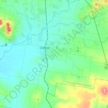
Name: Clifton topographic map, elevation, terrain.
Location: Clifton, Queensland, 4361, Australia (-27.96317 151.83988 -27.91230 151.99023)
Average elevation: 466 m
Minimum elevation: 424 m
Maximum elevation: 625 m
Other topographic maps
Click on a map to view its topography, its elevation and its terrain.
Clifton
Australia > Queensland > Clifton
Clifton, Toowoomba Regional, Queensland, 4361, Australia
Average elevation: 448 m