Geolocate

Greenock topographic map

Click on the map to display elevation.

About this map
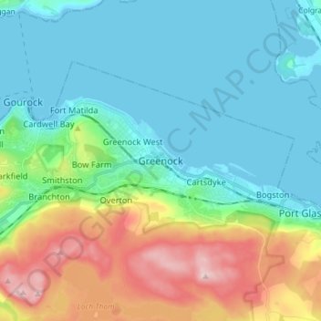
Name: Greenock topographic map, elevation, terrain.

Location: Greenock, Inverclyde, Scotland, PA15 1LS, United Kingdom (55.90734 -4.79647 55.98734 -4.71647)

Average elevation: 80 m

Minimum elevation: -2 m

Maximum elevation: 301 m

Other topographic maps

Click on a map to view its topography, its elevation and its terrain.

Gear up for your next adventure:

📕Australia Maps - Maps covering Australian regions
📸Action Cameras - Record your journey across interesting topographic features in 4K
📡Portable Emergency Radios - Stay informed about weather warnings and bushfire alerts
📡Weather Radios - Emergency weather radios
🚴Bike GPS - GPS devices for cycling

As an Amazon Associate, this site earns from qualifying purchases at no extra cost to you.