
Narni topographic map
Interactive map
Click on the map to display elevation.
About this map
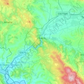
Name: Narni topographic map, elevation, terrain.
Location: Narni, TR, Umbria, 05035, Italy (42.42158 12.41137 42.60082 12.61466)
Average elevation: 250 m
Minimum elevation: 42 m
Maximum elevation: 1,017 m