
Étang salé topographic map
Interactive map
Click on the map to display elevation.
About this map
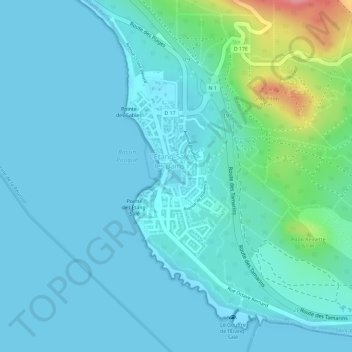
Name: Étang salé topographic map, elevation, terrain.
Average elevation: 19 m
Minimum elevation: 0 m
Maximum elevation: 113 m
Other topographic maps
Click on a map to view its topography, its elevation and its terrain.
Forêt Départemento-Domaniale de l'Étang-Salé
France > La Réunion > L'Étang-Salé > L'Étang-Salé les Bains
Forêt Départemento-Domaniale de l'Étang-Salé, L'Étang-Salé les Bains, L'Étang-Salé, Saint-Pierre, La Réunion, 97427, France
Average elevation: 63 m