Geolocate

Perkins topographic map

Click on the map to display elevation.

About this map
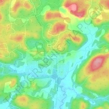
Name: Perkins topographic map, elevation, terrain.

Location: Perkins, Val-des-Monts, Les Collines-de-l'Outaouais, Outaouais, Quebec, J8N 7E7, Canada (45.58015 -75.63934 45.62015 -75.59934)

Average elevation: 151 m

Minimum elevation: 102 m

Maximum elevation: 227 m

Other topographic maps

Click on a map to view its topography, its elevation and its terrain.

Gear up for your next adventure:

👣Snake & Scrub Gaiters - Protection against spinifex, mud, and snakes while walking off-track
🔭Compact Hiking Binoculars - Lightweight optics for scouting routes or birdwatching
🔦LED Torches - LED torches for outdoor use
📍Handheld GPS - GPS devices for hiking and navigation
🔋Solar Power Banks - Charge your phone and GPS using the sun while deep in the bush

As an Amazon Associate, this site earns from qualifying purchases at no extra cost to you.