
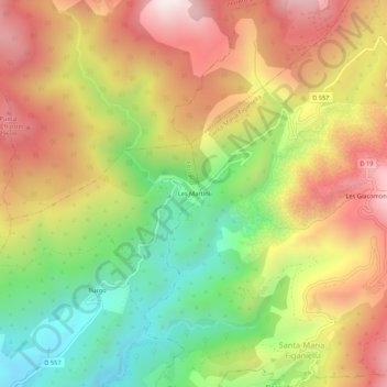
Les Martini topographic map
Interactive map
Click on the map to display elevation.
About this map
Name: Les Martini topographic map, elevation, terrain.
Average elevation: 486 m
Minimum elevation: 57 m
Maximum elevation: 915 m
Other topographic maps
Click on a map to view its topography, its elevation and its terrain.
Figaniella
France > Corse > Corse-du-Sud > Fozzano
Figaniella, Fozzano, Sartène, Corse-du-Sud, Corse, France métropolitaine, 20143, France
Average elevation: 442 m
Burgo
France > Corse > Corse-du-Sud > Fozzano
Burgo, Fozzano, Sartène, Corse-du-Sud, Corse, France métropolitaine, 20143, France
Average elevation: 325 m