
Montelungo topographic map
Interactive map
Click on the map to display elevation.
About this map
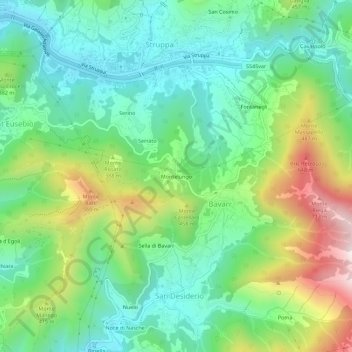
Name: Montelungo topographic map, elevation, terrain.
Location: Montelungo, Media Val Bisagno, Genova, Liguria, 16165, Italia (44.41597 8.99240 44.45597 9.03240)
Average elevation: 282 m
Minimum elevation: 51 m
Maximum elevation: 776 m
Other topographic maps
Click on a map to view its topography, its elevation and its terrain.