
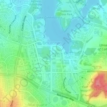
Margaret Timpson Park topographic map
Interactive map
Click on the map to display elevation.
About this map
Name: Margaret Timpson Park topographic map, elevation, terrain.
Average elevation: 600 m
Minimum elevation: 576 m
Maximum elevation: 667 m
Australia trails, hiking, mountain biking, running and outdoor activities
Other topographic maps
Click on a map to view its topography, its elevation and its terrain.
Fraser
Australia > District of Belconnen
Mount Rogers reserve is part of Fraser with an elevation of 704 metres (2,310 ft). Fraser has a neighbourhood oval and primary school. It is bordered to the north by Kuringa Drive.
Average elevation: 612 m