
La Janade topographic map
Interactive map
Click on the map to display elevation.
About this map
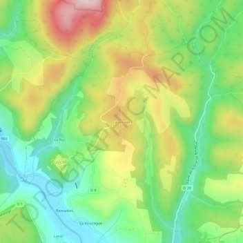
Name: La Janade topographic map, elevation, terrain.
Average elevation: 268 m
Minimum elevation: 130 m
Maximum elevation: 467 m
Other topographic maps
Click on a map to view its topography, its elevation and its terrain.
La Tounette
France > Occitanie > Tarn > Puycelsi
La Tounette, Prat Barrat, Puycelsi, Albi, Tarn, Occitanie, France métropolitaine, 81140, France
Average elevation: 241 m