
Picup topographic map
Interactive map
Click on the map to display elevation.
About this map
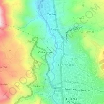
Name: Picup topographic map, elevation, terrain.
Location: Picup, Pongor, Independencia, Huaraz, Áncash, 02690, Perú (-9.53175 -77.55663 -9.49175 -77.51663)
Average elevation: 3,148 m
Minimum elevation: 2,956 m
Maximum elevation: 3,492 m
Other topographic maps
Click on a map to view its topography, its elevation and its terrain.
Cochapampa
Perú > Áncash > Independencia > Pongor
Cochapampa, Pongor, Independencia, Huaraz, Áncash, 02690, Perú
Average elevation: 3,165 m