
Vanier Island topographic map
Interactive map
Click on the map to display elevation.
About this map
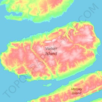
Name: Vanier Island topographic map, elevation, terrain.
Location: Vanier Island, Nunavut, Kanada (76.04072 -104.47775 76.32465 -102.50558)
Average elevation: 63 m
Minimum elevation: -5 m
Maximum elevation: 253 m
Other topographic maps
Click on a map to view its topography, its elevation and its terrain.