
Mörschwil topographic map
Interactive map
Click on the map to display elevation.
About this map
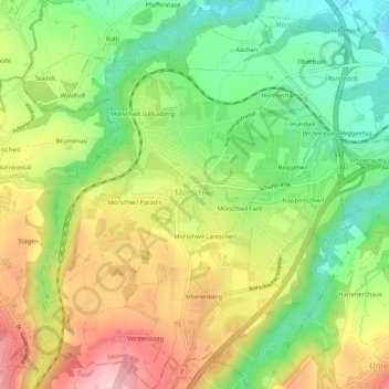
Name: Mörschwil topographic map, elevation, terrain.
Location: Mörschwil, Wahlkreis Rorschach, Sankt Gallen, 9402, Zwitserland (47.44941 9.40170 47.48514 9.45303)
Average elevation: 554 m
Minimum elevation: 436 m
Maximum elevation: 701 m