
Masindi topographic map
Interactive map
Click on the map to display elevation.
About this map
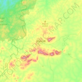
Name: Masindi topographic map, elevation, terrain.
Location: Masindi, Western Region, Uganda (1.52525 31.56059 1.84525 31.88059)
Average elevation: 1,102 m
Minimum elevation: 941 m
Maximum elevation: 1,396 m
The coordinates of Masindi are 1°41'01.0"N, 31°43'20.0"E (Latitude:1.683611; Longitude:31.722222). Masindi Town lies at an average elevation of1,227 metres (4,026 ft) above sea level.