Geolocate

Anos topographic map

Click on the map to display elevation.

About this map

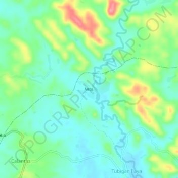
Name: Anos topographic map, elevation, terrain.

Location: Anos, Macalelon, Quezon, Calabarzon, 4309, Philippines (13.78081 122.13527 13.82081 122.17527)

Average elevation: 31 m

Minimum elevation: 2 m

Maximum elevation: 97 m

Gear up for your next adventure:

📻Handheld UHF Radios - Critical communication for groups in the Australian outback
🍴Titanium Spork & Cutlery - Indestructible and feather-light eating utensils
🎒40L Day Hiking Backpacks - Comfortable packs with hydration support for long days exploring topographic peaks
🍳Ultralight Camping Stoves - Boil water quickly for meals using minimal fuel
🎽Hiking Clothing - Breathable clothing for hiking

As an Amazon Associate, this site earns from qualifying purchases at no extra cost to you.