Geolocate

Linton topographic map

Click on the map to display elevation.

About this map
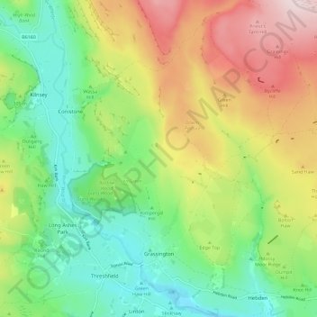
Name: Linton topographic map, elevation, terrain.

Location: Grassington, Linton, Craven, North Yorkshire, England, United Kingdom (54.05957 -2.03103 54.12641 -1.92510)

Average elevation: 310 m

Minimum elevation: 153 m

Maximum elevation: 555 m

Gear up for your next adventure:

📡Portable Emergency Radios - Stay informed about weather warnings and bushfire alerts
📚Map Reading & Navigation Guides - Master the art of interpreting topographic contours and symbols
🧥Thermal Emergency Blankets - Compact Mylar blankets to prevent hypothermia if stranded overnight
📟Satellite Messengers - Two-way satellite communication to stay in touch beyond the cellular grid
🎨Portable Watercolor Kits - Paint the landscapes and topographic views you discover

As an Amazon Associate, this site earns from qualifying purchases at no extra cost to you.