Geolocate

Caatinga do Moura topographic map

Click on the map to display elevation.

About this map
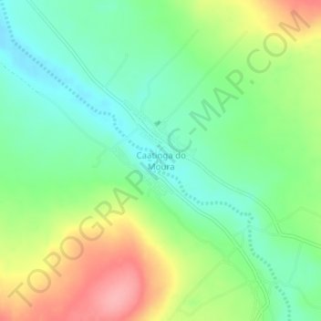
Name: Caatinga do Moura topographic map, elevation, terrain.

Location: Caatinga do Moura, Jacobina, Região Geográfica Imediata de Jacobina, Região Geográfica Intermediária de Feira de Santana, Bahia, Região Nordeste, Brasil (-10.99639 -40.78646 -10.95639 -40.74646)

Average elevation: 639 m

Minimum elevation: 598 m

Maximum elevation: 706 m

Other topographic maps

Click on a map to view its topography, its elevation and its terrain.

Junco

Brasil > Bahia > Jacobina

Average elevation: 404 m

Rio Itapicuru-Mirim

Brasil > Bahia > Jacobina

Average elevation: 620 m

Rio Itapicuru-Mirim

Brasil > Bahia > Jacobina

Average elevation: 469 m

Matriz

Brasil > Bahia > Jacobina

Average elevation: 540 m

Gear up for your next adventure:

🧯Animal Deterrent Spray - Safety spray for wildlife
🧢Wide Brim Sun Hats - Maximum coverage for the face and neck while out in the open
🔪Outdoor Multi-tools - Versatile tools for gear repair and survival tasks in the wilderness
📦Crushproof Equipment Cases - Safe transport for sensitive surveying and mapping instruments
📟Satellite Messengers - Two-way satellite communication to stay in touch beyond the cellular grid

As an Amazon Associate, this site earns from qualifying purchases at no extra cost to you.