
Make a donation
Gear up for your next adventure:
As an Amazon Associate, this site earns from qualifying purchases at no extra cost to you.
Wheeler Dam topographic map
Click on the map to display elevation.
Make a donation
Gear up for your next adventure:
As an Amazon Associate, this site earns from qualifying purchases at no extra cost to you.
Wheeler Dam
The stretch of the Tennessee River between Decatur and Florence drops over 130 feet (40 m) in elevation, creating what was once a series of rapids known as the Muscle Shoals and the Elk River Shoals. Along with the Tennessee River Gorge to the east, these shoals had long been an impediment to river navigation, effectively isolating the upper Tennessee Valley from the nation's major inland waterways. Canal work in the 19th century had improved navigation through the shoals, but were insufficient for major river traffic. In 1898, Congressman Joe Wheeler introduced legislation in Congress that obtained federal funding for navigation improvements. The construction of Wilson Dam in the 1920s and various other improvements helped create a 6-foot (1.8 m) channel over the shoals, but even then navigation was only possible during times of high water flow. The Corps of Engineers had planned to build a dam at the Wheeler site in the early 1930s, and had gained authorization for the dam's lock, although the project was assumed by the Tennessee Valley Authority shortly after the Authority's creation in 1933. Construction work on Wheeler Dam began on November 21, 1933, the second major dam construction project (after Norris) attempted by TVA.
Make a donation
Gear up for your next adventure:
As an Amazon Associate, this site earns from qualifying purchases at no extra cost to you.
About this map
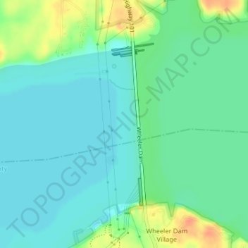
Name: Wheeler Dam topographic map, elevation, terrain.
Location: Wheeler Dam, Lauderdale County, Alabama, United States (34.79670 -87.38535 34.81428 -87.37986)
Average elevation: 167 m
Minimum elevation: 155 m
Maximum elevation: 196 m
Make a donation
Gear up for your next adventure:
As an Amazon Associate, this site earns from qualifying purchases at no extra cost to you.