Geolocate

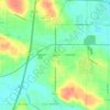
Springfield Township topographic map

Click on the map to display elevation.

About this map

Name: Springfield Township topographic map, elevation, terrain.

Location: Springfield Township, Summit County, Ohio, United States (40.98815 -81.49237 41.06677 -81.39296)

Average elevation: 343 m

Minimum elevation: 308 m

Maximum elevation: 385 m

Other topographic maps

Click on a map to view its topography, its elevation and its terrain.

Boston

United States > Ohio > Summit County

Average elevation: 245 m

Greensburg

United States > Ohio > Summit County > Green

Average elevation: 358 m

Six Corners

United States > Ohio > Summit County > Tallmadge

Average elevation: 350 m

Metz

United States > Ohio > Summit County > Stow

Average elevation: 318 m

Copley

United States > Ohio > Summit County

Average elevation: 318 m

North Springfield

United States > Ohio > Summit County > Akron

Average elevation: 336 m

Copley

United States > Ohio > Summit County

Average elevation: 318 m

Copley

United States > Ohio > Summit County

Average elevation: 318 m

Sagamore Hills

United States > Ohio > Summit County

Average elevation: 264 m

Maple Grove Park

United States > Ohio > Summit County > Hudson

Average elevation: 316 m

Gear up for your next adventure:

🕶️Polarized Sunglasses - UV protection sunglasses for outdoors
🪑Portable Backpacking Chairs - A comfortable seat for studying maps at the end of the day
🚴Bike GPS - GPS devices for cycling
🌧️Rain Jackets - Waterproof jackets for hiking
📖Australian Bush Survival Books - Local knowledge on finding water and surviving the outback

As an Amazon Associate, this site earns from qualifying purchases at no extra cost to you.