
Make a donation
Gear up for your next adventure:
As an Amazon Associate, this site earns from qualifying purchases at no extra cost to you.
Karimpur topographic map
Click on the map to display elevation.
Make a donation
Gear up for your next adventure:
As an Amazon Associate, this site earns from qualifying purchases at no extra cost to you.
Karimpur
Karimpur is located at 23°58′N 88°37′E / 23.97°N 88.62°E / 23.97; 88.62. It has an average elevation of 15 metres (49 ft). It is 183 km (114 mi) from Kolkata and is located at the bank of the River Jalangi.
Make a donation
Gear up for your next adventure:
As an Amazon Associate, this site earns from qualifying purchases at no extra cost to you.
About this map
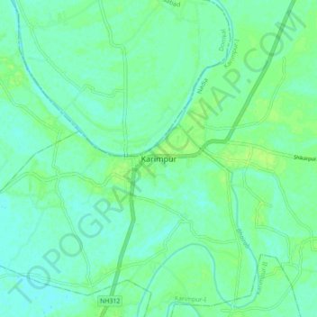
Name: Karimpur topographic map, elevation, terrain.
Location: Karimpur, Karimpur-I, Nadia, West Bengal, 741152, India (23.94160 88.58961 24.02160 88.66961)
Average elevation: 18 m
Minimum elevation: 13 m
Maximum elevation: 24 m
Make a donation
Gear up for your next adventure:
As an Amazon Associate, this site earns from qualifying purchases at no extra cost to you.