Geolocate

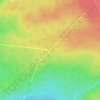
Salmon River Rd topographic map

Click on the map to display elevation.

About this map

Name: Salmon River Rd topographic map, elevation, terrain.

Location: Salmon River Rd, Chipman Parish, Municipality of Grand Lake, Queens County, New Brunswick, Canada (46.26275 -65.84754 46.34084 -65.60439)

Average elevation: 70 m

Minimum elevation: 0 m

Maximum elevation: 130 m

Other topographic maps

Click on a map to view its topography, its elevation and its terrain.
Gear up for your next adventure:

🍶Collapsible Water Bottles - Save space in your pack as you consume your water supply
🕶️Polarized Sunglasses - UV protection sunglasses for outdoors
🎒Ultralight Backpacks - Lightweight packs for long hikes
🧼Clip-on Hand Sanitizer - Maintain hygiene when water for washing is scarce
🥶Thermal Beanies - Warm hats for cold hikes

As an Amazon Associate, this site earns from qualifying purchases at no extra cost to you.