
Taliabu Island topographic map
Interactive map
Click on the map to display elevation.
About this map
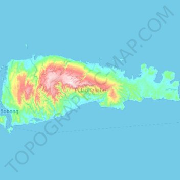
Name: Taliabu Island topographic map, elevation, terrain.
Location: Taliabu Island, Pulau Taliabu, North Maluku, Indonesia (-2.03323 124.33682 -1.62998 125.32676)
Average elevation: 76 m
Minimum elevation: -1 m
Maximum elevation: 1,380 m