Geolocate

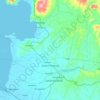
Matanog topographic map

Click on the map to display elevation.

About this map

Name: Matanog topographic map, elevation, terrain.

Location: Matanog, Maguindanao del Norte, Bangsamoro, 9613, Philippines (7.42685 124.21857 7.50685 124.29857)

Average elevation: 312 m

Minimum elevation: 5 m

Maximum elevation: 1,051 m

Other topographic maps

Click on a map to view its topography, its elevation and its terrain.

Talitay

Philippines > Maguindanao del Norte

Average elevation: 8 m

Gear up for your next adventure:

🧥Insulated Down Jackets - High warmth-to-weight ratio for cold nights in the high country
🚴Cycling Backpacks - Backpacks for cyclists
📡Weather Radios - Emergency weather radios
🧢Wide Brim Sun Hats - Maximum coverage for the face and neck while out in the open
🧴SPF 50+ Bulk Sunscreen - Maximum protection for long-term outdoor exposure

As an Amazon Associate, this site earns from qualifying purchases at no extra cost to you.