Geolocate

Chester topographic map

Click on the map to display elevation.

Chester

Being at a low elevation between Philadelphia and Wilmington, Chester experiences a humid subtropical climate (Cfa.) The hardiness zone is 7b. Archived 2014-02-09 at the Wayback Machine

About this map

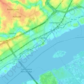
Name: Chester topographic map, elevation, terrain.

Location: Chester, Delaware County, Pennsylvania, 19013, United States (39.81731 -75.40808 39.87584 -75.34209)

Average elevation: 10 m

Minimum elevation: -2 m

Maximum elevation: 39 m

Gear up for your next adventure:

🎒Daypacks - Compact backpacks for short hikes
🧺Fast-Dry Microfiber Towels - Large towels that pack down to the size of an orange
🌿Flora and Fauna Field Guides - Identify the plants and animals you encounter on your route
🖼️Scratch-off Australia Map - Track the regions and peaks you have explored geographically
🧥Insulated Down Jackets - High warmth-to-weight ratio for cold nights in the high country

As an Amazon Associate, this site earns from qualifying purchases at no extra cost to you.