
Thank you for supporting this site ❤️
Make a donation
Make a donation
Gear up for your next adventure:
As an Amazon Associate, this site earns from qualifying purchases at no extra cost to you.
Towaoc topographic map
Click on the map to display elevation.
Thank you for supporting this site ❤️
Make a donation
Make a donation
Gear up for your next adventure:
As an Amazon Associate, this site earns from qualifying purchases at no extra cost to you.
About this map
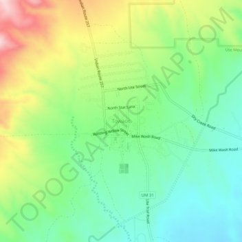
Name: Towaoc topographic map, elevation, terrain.
Location: Towaoc, Montezuma County, Colorado, United States (37.18444 -108.74954 37.22444 -108.70954)
Average elevation: 1,809 m
Minimum elevation: 1,696 m
Maximum elevation: 2,010 m
Thank you for supporting this site ❤️
Make a donation
Make a donation
Gear up for your next adventure:
As an Amazon Associate, this site earns from qualifying purchases at no extra cost to you.