
Bjelovar topographic map
Interactive map
Click on the map to display elevation.
About this map
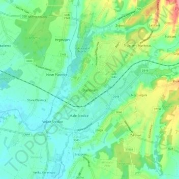
Name: Bjelovar topographic map, elevation, terrain.
Average elevation: 147 m
Minimum elevation: 96 m
Maximum elevation: 278 m
Bjelovar befindet sich auf einer Ebene südlich des Bilogora-Gebirges. Die Stadtfläche erstreckt sich auf 191,9 km² und befindet sich auf 130 m Meereshöhe.