Geolocate

Pastolan topographic map

Click on the map to display elevation.

About this map

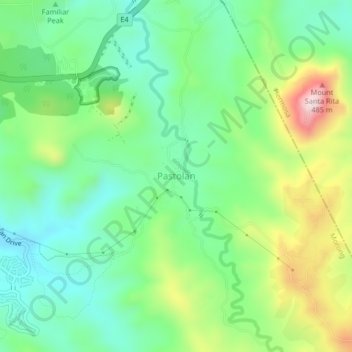
Name: Pastolan topographic map, elevation, terrain.

Location: Pastolan, Morong, Bataan, Central Luzon, 2108, Philippines (14.79376 120.32757 14.83376 120.36757)

Average elevation: 168 m

Minimum elevation: 32 m

Maximum elevation: 442 m

Other topographic maps

Click on a map to view its topography, its elevation and its terrain.

Sabang River

Philippines > Bataan > Morong > Bernabe

Average elevation: 14 m

Gear up for your next adventure:

🕯️Emergency Whistles - Safety whistles for hiking
🔭Compact Hiking Binoculars - Lightweight optics for scouting routes or birdwatching
🪢Paracord - Multi-purpose survival cord
🌧️Rain Jackets - Waterproof jackets for hiking
🎒Hiking Backpacks - Backpacks designed for hiking and trekking

As an Amazon Associate, this site earns from qualifying purchases at no extra cost to you.