
Kyota topographic map
Interactive map
Click on the map to display elevation.
About this map
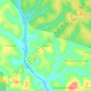
Name: Kyota topographic map, elevation, terrain.
Location: Kyota, Mubende, Central Region, Uganda (0.59299 31.43424 0.63299 31.47424)
Average elevation: 1,277 m
Minimum elevation: 1,240 m
Maximum elevation: 1,339 m