Geolocate

Basildon topographic map

Click on the map to display elevation.

About this map

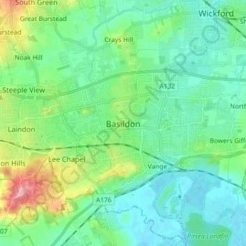
Name: Basildon topographic map, elevation, terrain.

Location: Basildon, Essex, East of England, England, SS14 2QN, United Kingdom (51.53546 0.43574 51.61546 0.51574)

Average elevation: 29 m

Minimum elevation: -3 m

Maximum elevation: 121 m

Gear up for your next adventure:

📚Map Reading & Navigation Guides - Master the art of interpreting topographic contours and symbols
🩹First Aid Kits - Emergency kits for hiking
🖼️Scratch-off Australia Map - Track the regions and peaks you have explored geographically
🎧Bluetooth Outdoor Earbuds - Listen to navigation cues or podcasts during long solo treks
🛌Sleeping Bags - Sleeping bags for outdoor camping

As an Amazon Associate, this site earns from qualifying purchases at no extra cost to you.