Geolocate

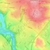
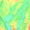
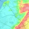
Latteridge topographic map

Click on the map to display elevation.

About this map

Name: Latteridge topographic map, elevation, terrain.

Location: Latteridge, South Gloucestershire, West of England, England, BS37 9TW, United Kingdom (51.54022 -2.50566 51.58022 -2.46566)

Average elevation: 60 m

Minimum elevation: 47 m

Maximum elevation: 91 m

Other topographic maps

Click on a map to view its topography, its elevation and its terrain.

Filton

United Kingdom > England > South Gloucestershire

Average elevation: 67 m

Yate

United Kingdom > England > South Gloucestershire

Average elevation: 83 m

Pucklechurch

United Kingdom > England > South Gloucestershire

The land of Pucklechurch is relatively prominent in elevation compared to surrounding areas and as such it was selected in the Bronze Age as the site of a tumulus (round barrow) at Shortwood Hill.

Average elevation: 98 m

Siston

United Kingdom > England > South Gloucestershire

Average elevation: 80 m

Doynton

United Kingdom > England > South Gloucestershire

Average elevation: 129 m

Horton

United Kingdom > England > South Gloucestershire

Average elevation: 132 m

Aust

United Kingdom > England > South Gloucestershire

Average elevation: 9 m

Sodbury

United Kingdom > England > South Gloucestershire

Average elevation: 122 m

Yate

United Kingdom > England > South Gloucestershire

Average elevation: 83 m

Aust

United Kingdom > England > South Gloucestershire

Average elevation: 9 m

Aust

United Kingdom > England > South Gloucestershire

Average elevation: 9 m

Aust

United Kingdom > England > South Gloucestershire

Average elevation: 9 m

Aust

United Kingdom > England > South Gloucestershire

Average elevation: 9 m

Pucklechurch

United Kingdom > England > South Gloucestershire

Shortwood is located to the east of the A4174 and to the west of Pucklechurch village, sitting lower in the landscape topography against the Pucklechurch ridge and adjacent to Emerson’s Green and Mangotsfield. It is largely a linear settlement (comprising approximately 73 households) washed over by the Green…

Average elevation: 98 m

Yate

United Kingdom > England > South Gloucestershire

Average elevation: 83 m

Gear up for your next adventure:

☕Outdoor Coffee Makers - Enjoy quality coffee at the summit of your favorite peak
📻Handheld UHF Radios - Critical communication for groups in the Australian outback
🎒40L Day Hiking Backpacks - Comfortable packs with hydration support for long days exploring topographic peaks
📡Portable Emergency Radios - Stay informed about weather warnings and bushfire alerts
🛌Sleeping Mats - Insulated mats for camping comfort

As an Amazon Associate, this site earns from qualifying purchases at no extra cost to you.