
Auf dem Kiewitt topographic map
Interactive map
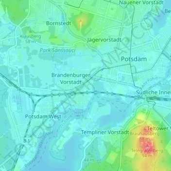
Click on the map to display elevation.
About this map
Name: Auf dem Kiewitt topographic map, elevation, terrain.
Average elevation: 40 m
Minimum elevation: 29 m
Maximum elevation: 96 m
Other topographic maps
Click on a map to view its topography, its elevation and its terrain.
Potsdam
Germany > Brandenburg > Potsdam
The traditional towns in the governorate were small, however, in the course of the industrial labour migration some reached the rank of urban districts. The principal towns were Brandenburg upon Havel, Köpenick, Potsdam, Prenzlau, Spandau and Ruppin. Until 1875 Berlin also was a town within the governorate.…
Average elevation: 40 m