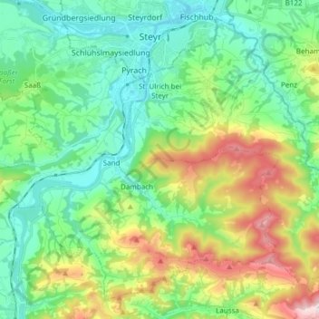
Sankt Ulrich bei Steyr topographic map
Interactive map
Click on the map to display elevation.
About this map
Name: Sankt Ulrich bei Steyr topographic map, elevation, terrain.
Average elevation: 464 m
Minimum elevation: 280 m
Maximum elevation: 906 m

Click on the map to display elevation.
Name: Sankt Ulrich bei Steyr topographic map, elevation, terrain.
Average elevation: 464 m
Minimum elevation: 280 m
Maximum elevation: 906 m