
Willingen topographic map
Interactive map
Click on the map to display elevation.
About this map
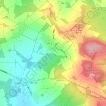
Name: Willingen topographic map, elevation, terrain.
Average elevation: 586 m
Minimum elevation: 523 m
Maximum elevation: 665 m
Other topographic maps
Click on a map to view its topography, its elevation and its terrain.
Linden
Germany > Rhineland-Palatinate > Westerwaldkreis
Linden, Hachenburg, Westerwaldkreis, Rhineland-Palatinate, Germany
Average elevation: 453 m
Bellingen
Germany > Rhineland-Palatinate > Westerwaldkreis
Bellingen, Westerburg, Westerwaldkreis, Rhineland-Palatinate, Germany
Average elevation: 457 m