
Den Dungen topographic map
Interactive map
Click on the map to display elevation.
About this map
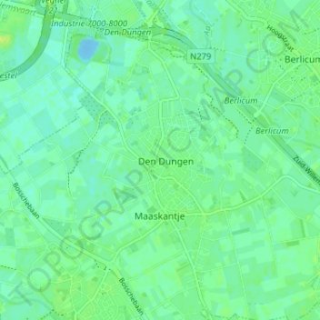
Name: Den Dungen topographic map, elevation, terrain.
Location: Den Dungen, Noord-Brabant, Nederland, 5275, Nederland (51.64570 5.35014 51.68570 5.39014)
Average elevation: 5 m
Minimum elevation: -11 m
Maximum elevation: 12 m
Other topographic maps
Click on a map to view its topography, its elevation and its terrain.
Poeldonk
Nederland > Noord-Brabant > Den Dungen
Poeldonk, Den Dungen, Sint-Michielsgestel, Noord-Brabant, Nederland, 5275 HJ, Nederland
Average elevation: 5 m