
Rodange topographic map
Interactive map
Click on the map to display elevation.
About this map
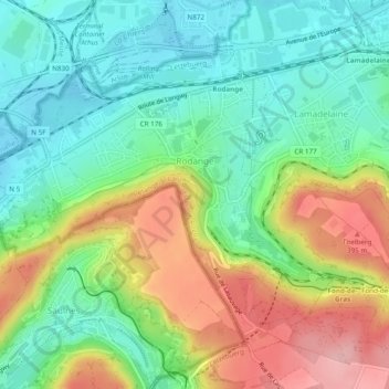
Name: Rodange topographic map, elevation, terrain.
Location: Rodange, Pétange, Canton Esch-sur-Alzette, Luxemburg (49.52923 5.80813 49.55450 5.85623)
Average elevation: 320 m
Minimum elevation: 261 m
Maximum elevation: 418 m